UN
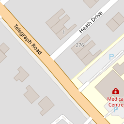
7 Heath Drive
£ 325,000
Description
We don't have a Description for this property.
- Bedrooms
- 3
- Bathrooms
- 0

Leaflet © OpenStreetMap contributors
The heatmap indicates the level of crime in the area. The color of the heatmap indicates the crime severity and recency.
Metrics Year-on-Year
- Average area value
- 614,428.00 £Increased by 5.11 %
- Average area rental value
- 1,569.00 £/moIncreased by 44.21 %
- Est rental Yield
- 3.06 %Increased by 37.22 %
- Crime Rate
- 7.00 %Unchanged by 0.00 %
from 584,545.00 £
from 1,088.00 £/mo
from 2.23 %
from 7.00 %
Nearby Schools
| Name | Type | Ofsted | Distance |
|---|---|---|---|
| Heswall St Peter'S Cofe Primary School | Voluntary Aided School | Good | 0.60 KM |
| Ladymount Catholic Primary School | Voluntary Aided School | Good | 1.23 KM |
| Heswall Primary School | Community School | Good | 1.28 KM |
| Pensby Primary School | Community School | Good | 1.31 KM |
| Stanley School | Community Special School | Good | 1.35 KM |
Images
Nearby Streets
| Name | Average Price | Average Sqft | Distance |
|---|---|---|---|
| Heath Drive | £ 450,000 | 0 | 0.00 KM |
| Grove Avenue | £ 0 | 0 | 0.00 KM |
| Circular Drive | £ 600,000 | 0 | 0.00 KM |
| Dawstone Court | £ 0 | 0 | 0.00 KM |
| Richmond Way | £ 315,000 | 0 | 0.00 KM |
Nearby Transport
| Name | NLC | TLC | Distance |
|---|---|---|---|
| Heswall | 2138 | HSW | 3.16 KM |
| Neston | 2139 | NES | 6.12 KM |
| Upton (Merseyside) | 2141 | UPT | 6.51 KM |
| Moreton (Merseyside) | 2151 | MRT | 8.59 KM |
| Leasowe | 2237 | LSW | 8.60 KM |
Nearby Listings
| Address | Price | Type | Score | Distance |
|---|---|---|---|---|
| Heath Drive, Heswall, Wirral | £ 375,000 | BUY | Unknown | 0.01 KM |
| Telegraph Road, Heswall, Wirral, CH60 | £ 155,000 | BUY | Unknown | 0.08 KM |
| Poll Hill Road, Heswall, Wirral | £ 400,000 | BUY | 6 / 10 | 0.10 KM |
| Telegraph Road, Heswall, Wirral | £ 250,000 | BUY | 6 / 10 | 0.13 KM |
| Poll Hill Road, Heswall, Wirral | £ 425,000 | BUY | Unknown | 0.14 KM |
Nearby Properties
| Address | Price | Distance |
|---|---|---|
| 7 Heath Drive | £ 325,000 | 0.00 KM |
| 1 Heath Drive | £ 299,950 | 0.00 KM |
| 2 Heath Drive | £ 209,000 | 0.00 KM |
| 5 Heath Drive | £ 278,000 | 0.01 KM |
| 7 Poll Hill Road | £ 263,200 | 0.13 KM |